Our Resources
Equipped with cutting-edge survey technology and skilled personnel, Focus Geo Survey delivers precise marine, terrestrial, and aerial data collection for comprehensive project insights.
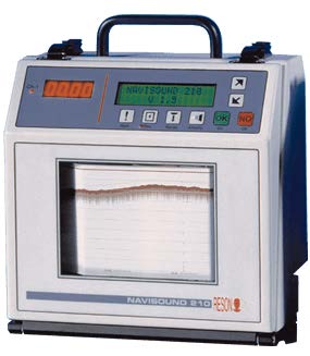
SINGLE BEAM ECHO SOUNDER
A Single Beam Echo Sounder is a hydrographic tool that provides precise depth measurements using high-frequency acoustic pulses. It is widely used for surveying rivers, lakes, reservoirs, ports, and shallow coastal zones. This system is ideal for dredging projects, as-built verification, and small to medium-scale seabed mapping, delivering reliable and accurate depth data for a variety of marine applications.
MULTIBEAM ECHO SOUNDER
A Multibeam Echo Sounder is a high-performance seabed mapping system that delivers full-coverage bathymetry using hundreds of simultaneous acoustic beams. It captures highly accurate depth data, seabed morphology, and surface texture, making it essential for large-scale hydrographic operations. MBES is commonly used for nautical charting, offshore construction planning, pipeline route surveys, navigational safety assessments, dredging volume estimation, and detailed 3D seabed modelling.
SIDE SCAN SONAR
Side Scan Sonar is a high-resolution underwater imaging system that uses high-frequency acoustic pulses to create detailed visual representations of the seabed or riverbed. It can detect submerged objects, underwater structures, wrecks, debris, and variations in seabed texture with exceptional clarity.
This system is widely applied in obstacle detection, navigation safety surveys, subsea cable and pipeline pre-installation assessments, marine forensic investigations, and geophysical seabed mapping. With its broad coverage and high-resolution imagery, Side Scan Sonar is an essential tool for engineering projects, safety operations, and marine environmental monitoring.
SUB-BOTTOM PROFILER
A Sub-Bottom Profiler is a marine geophysical system that uses low- to mid-frequency acoustic pulses to penetrate beneath the seabed or riverbed and produce detailed subsurface profiles. It reveals sediment layers, geological structures, buried objects, and stratigraphy, supporting applications such as geotechnical studies, subsea cable and pipeline route planning, seabed stability assessments, dredging investigations, and marine research. With its deep penetration and high-resolution imaging capabilities, the Sub-Bottom Profiler delivers essential insights into subsurface conditions that cannot be obtained through conventional hydrographic instruments.

MAGNETOMETER
A Marine Magnetometer is a high-sensitivity geophysical instrument used to detect variations in the Earth’s magnetic field, allowing the identification of buried ferrous objects on or beneath the seabed. It can locate pipelines, cables, anchors, submerged equipment, UXO, and shipwrecks – even when buried under sediment – making it essential for utility detection, UXO surveys, marine archaeology, pipeline and cable route assessments, and large-scale geophysical mapping.

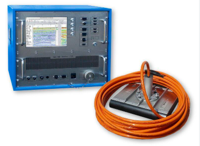
ACOUSTIC DOPPLER CURRENT PROFILER
An Acoustic Doppler Current Profiler (ADCP) is a high-precision instrument that measures water current speed and direction throughout the water column using acoustic pulses and the Doppler effect. It provides detailed vertical or horizontal current profiles for applications such as tidal studies, long-term current monitoring, river flow analysis, coastal engineering, flood mitigation, and hydrodynamic modelling, delivering essential data for navigation safety and coastal development planning. With the ability to measure multiple layers of water simultaneously, the ADCP provides essential data for navigation safety, flood mitigation, engineering studies, and coastal development planning.
SUB-MERGE TIDE GAUGE
A Submerged Tide Gauge is a high-precision instrument that records continuous water level changes using a pressure sensor installed on the seabed, riverbed, or lakebed. Unaffected by waves or surface disturbances, it provides stable and accurate data for tidal studies, long-term water level monitoring, marine structure design, flood management, hydrodynamic modelling, and coastal environmental research.
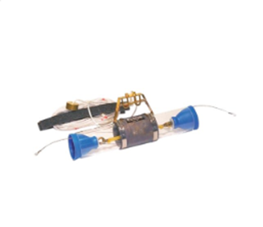
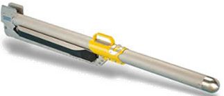
WATER SAMPLER
A 1-Liter Water Sampler is a precision tool used to collect uncontaminated water samples at specific depths in rivers, lakes, reservoirs, and marine environments. Its secure closing mechanism preserves true water column conditions, making it essential for water quality testing, environmental monitoring, pollution assessments, and scientific studies across hydrographic, governmental, and environmental sectors.
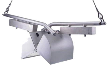
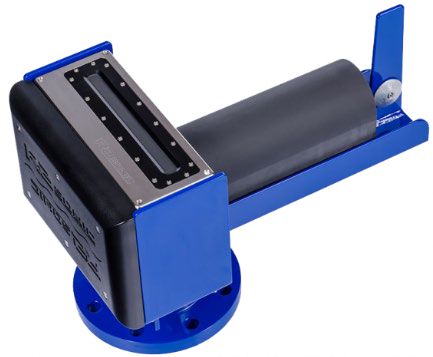
GRAB SAMPLER
A 1KG Grab Sampler is a sediment sampling tool designed to efficiently collect surface seabed or riverbed material while preserving true surface conditions. Its secure mechanism prevents sample loss during retrieval, making it ideal for geotechnical surface investigations, sediment quality monitoring, pollution assessments, benthic studies, dredging management, and environmental impact evaluations.
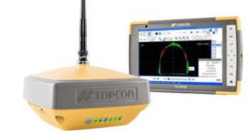
GLOBAL NAVIGATION SATELLITE SYSTEM
GNSS (Global Navigation Satellite System) equipment provides centimetre-level positioning accuracy for both marine and land surveying. In hydrographic work, it integrates with systems like single beam, multibeam, side scan sonar, and ADCP to deliver stable real-time coordinates even during vessel movement. On land, it supports topographic mapping, setting-out, structural monitoring, boundary surveys, and geodetic control. Modern GNSS receivers use multi-constellation signals (GPS, GLONASS, Galileo, BeiDou) and advanced methods such as RTK, PPK, and dual-antenna heading to ensure high accuracy, stability, and reliability.
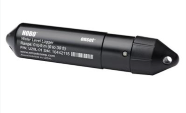
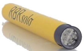
WATER TEMPERATURE
A Water Temperature Logger is a high-precision instrument that continuously records water temperature using sensitive thermistor or digital sensors. Compact, waterproof, and pressure-resistant, it can be deployed on buoys, structures, or directly on the riverbed or seabed. Its data supports water quality assessments, hydrological modelling, ecological studies, and environmental impact monitoring across rivers, lakes, reservoirs, estuaries, and marine environments.
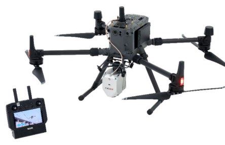
UAV LiDAR
Drone-based LiDAR is a high-precision aerial mapping technology that uses laser sensors to generate accurate 3D models of the Earth’s surface, even through dense vegetation. Mounted on UAVs, it captures millions of points per second, enabling fast, detailed mapping of complex or rugged terrain. With centimetre-level accuracy and rapid coverage, Drone LiDAR supports engineering surveys, volumetric calculations, topographic mapping, urban planning, forestry studies, landslide and flood risk assessments, and long-term terrain monitoring – offering reduced field time, lower costs, and high-density datasets for advanced analysis.
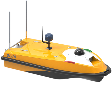
UNMANNED SURFACE VEHICLE
Single Beam by USV integrates a Single Beam Echo Sounder with an unmanned surface platform to collect precise bathymetric data safely and efficiently without placing operators on the water. Ideal for shallow, hazardous, narrow, or hard-to-access areas, the system uses autonomous navigation, GNSS/RTK positioning, and high-precision depth sensors to deliver reliable data for rivers, lakes, reservoirs, and coastal zones. It reduces operational risk, lowers costs, and enhances efficiency for routine monitoring, engineering studies, and small to medium-scale hydrographic mapping.
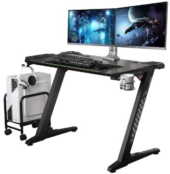
HIGH-PERFORMANCE WORKSTATION
High-Performance Workstation is a specialized computing system built for demanding technical workflows such as multibeam bathymetry processing, LiDAR point cloud analysis, 3D modelling, geophysical interpretation, graphic rendering and engineering simulations. Powered by multi-core CPUs, professional GPUs, large RAM capacity and ultra-fast NVMe storage, it delivers exceptional speed and stability for handling large datasets. Essential for hydrography, geospatial mapping, GIS, BIM, drone data processing and big-data analysis, this workstation boosts productivity and ensures reliable performance for precision-driven operations.

DATA PROCESSING WORKSTATION
A Medium Workstation for Simple Data Processing is a mid-level computing system designed for light to moderate workloads such as basic GIS operations, single-beam processing, survey data compilation, map preparation, small-scale drone imagery analysis and technical reporting. With a reliable CPU, adequate RAM and fast SSD storage, it offers balanced, cost-effective performance for routine office tasks including data QC, format conversion, map editing and basic analysis in software like QGIS, Global Mapper and AutoCAD LT.
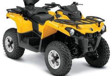
ALL TERRAIN VEHICLE (ATV)
An All-Terrain Vehicle (ATV) is a versatile off-road vehicle designed to operate across rocky, muddy, sandy and steep terrains, making it ideal for hydrographic fieldwork, geotechnical surveys, instrument deployment, river monitoring, site inspections and transporting equipment to remote locations. Built with a durable chassis, high-traction tires and a powerful engine, it provides fast, reliable access to challenging project areas while reducing field travel time and boosting operational productivity.
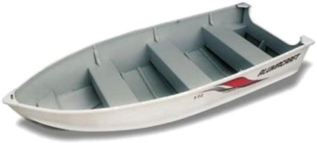
SMALL SURVEY BOAT WITH OUTBOARD ENGINE
A 14-ft Small Survey Boat with an outboard engine is a compact and agile hydrographic vessel designed for surveying rivers, lakes, reservoirs, shallow waters and coastal zones. It supports key instruments such as single beam, multibeam, side scan sonar, ADCP, GNSS and water quality sensors. With a stable lightweight hull for easy launching – even without a jetty – and practical mounting space for equipment, it offers reliable maneuverability and efficient performance for bathymetry, river mapping, reservoir studies, dredging monitoring and routine hydrographic operations.